Protecting vulnerable communities from urban heatwaves
Published on: June 1, 2026
Heatwaves are becoming more frequent at the same time as Europe’s population is ageing — a combination that increases pressure on cities and public services. Without adaptation, vulnerable groups face disproportionate impacts on health and wellbeing. Addressing this requires cities to combine climate analysis with inclusive planning and long-term resilience measures.
Human vulnerability to climate change is directly related to the adaptive capacity of the built environment, the possibility for change, social processes and institutional structures of a particular urban context.
Human health is particularly vulnerable to extreme heat. Studies highlight the following:
- 489,000 excess deaths (2000-2019) were due to heat globally, with over 20,000 excess deaths/year across 854 cities in Europe.
- 37% of warm-season, heat-related deaths (1991-2018) are directly attributable to anthropogenic climate change.
- There is a clear causal relationship between increased levels of air pollution and extreme heat, with air pollution consistently increasing respiratory and cardiovascular disease-induced mortality during the warmest months of the year.
More frequent and intense heatwaves will affect citizens around the world, but their effects will not be felt equally. Cascade effects resulting from heatwaves, such as drought, access to food, employment, ecosystem collapse, biodiversity loss and mental health challenges, can trigger additional crises in various areas.
Each city will have its own adaptive capacities across each of these dimensions. However, what remains consistent across cities is the absence of adaptation measures that include communities, especially those particularly vulnerable to heatwaves.
For example, a 2018 study found that people living in urban areas with less green space, which is highly correlated with negative socio-economic indicators, have a 5% higher risk of dying from heat-related causes. Additionally, research highlights how vulnerable groups across European countries are particularly susceptible to increased mortality from heart and lung diseases, accelerated by the interactive effects of air pollution and extreme heat.
“The presence of extensive green areas in a neighborhood can help lower the overall average temperature, but higher surface temperatures in specific residential and commercial areas can still be problematic, especially in schools, elderly care, and health facilities,” says Laura Roemer, Water and Climate department, Sweco Denmark.
Strategies to protect vulnerable communities in six European cities
Brussels: Brussels’ heatwave plan allows vulnerable individuals to register, so that when temperatures exceed 28 degrees, a phone number can be used to seek help. Dedicated teams help by providing regular contact, water and home visits to check citizens’ living conditions.
Copenhagen: As part of its 2011 Adaptation Plan, the city produced a visual map of surface temperatures during a 2006 heatwave, identifying vulnerable areas to focus on and target measures. However, despite contemporary research highlighting the increase of heat-related morbidity for vulnerable populations during heatwaves,56 while the municipality identifies vulnerable groups, the sick, the elderly and children, it does not include specific policy measures targeting these groups.
Helsinki: In 2015, the Helsinki Region Environmental Services Authority leveraged GIS and city socio-economic data to assess vulnerability to extreme heat according to age, health, income, education and social networks. Updated climate vulnerability mapping is underway as part of the CHAMPS programme, a research consortium between higher education and government institutions.
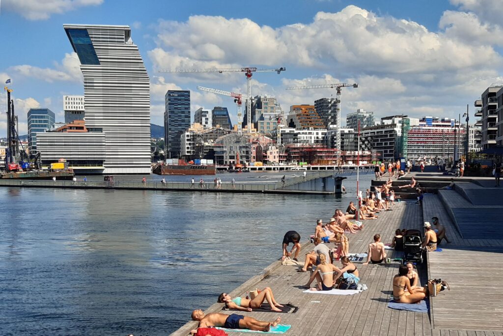
Oslo: The climate change vulnerability analysis for Oslo (2020) assesses impacts of climate change on Oslo and the city’s ability to adapt to these. One finding in the analysis was that there is limited research and mapping of the effects of higher temperatures in Oslo. With a changing climate, the weather in Oslo is becoming wetter and warmer.
“Increasing temperatures results in more subtle challenges to public health and nature. Therefore, the municipality are developing solutions to manage higher temperatures, especially for vulnerable population groups, in addition to strengthening biological diversity. We experience that many nature-based solutions to manage storm water is also beneficial for increasing temperature related challenges, such as securing green areas, planting threes, and reopening streams,” says Guro Sørnes Kjerschow, special advisor for climate change adaptation at the City of Oslo.
Rotterdam: Rotterdam developed an Interactive Climate Atlas used to create a city-wide heat risk map highlighting the UHI effects by 2050 and focusing on the concentrations of vulnerable communities like the elderly and nursing homes, as well as offices.
Stockholm: Our interview with city representatives highlighted several measures the City of Stockholm is developing and collaborating on to increase the resilience of vulnerable communities to extreme heat. These include:
- City-wide heat analysis and vulnerability mapping focussed on schools, preschools, retirement homes and areas of the city with a high proportion of elderly residents.
- Targeted messages sent to businesses warning about high temperatures, giving them sufficient time to prepare for the heat and reducing economic vulnerability.
- MiCasa – the primary provider of residential care homes and serviced housing apartments owned by the city – have conducted mappings for their buildings, ensuring efficient, targeted maintenance of homes experiencing heat stress.
- Installation of thermometers in schools to inform city policy on school opening times during the summer months.

Addressing heat challenges for residents
Urban heat map Odense Municipality has wanted to map out how the higher temperatures of the future will affect the municipality. Sweco has therefore contributed by preparing an urban heat map of the entire municipality. Heat-related challenges have been mapped, and focus areas have been identified where vulnerable groups are particularly exposed. The designated focus areas concern the areas of the city that are at particular risk of overheating and where vulnerable citizens, such as children and the elderly, reside.
Solutions to Odense’s heat-related challenges involve green optimisations such as water management and bright surfaces, and initiatives that increase biodiversity, including evaporation promoting elements such as planting on surfaces and facades as well as more trees in selected areas. These measures will all contribute to reducing the temperature in the city and provide cooling properties.
“An urban heat map will function as a resource-efficient and comprehensive mapping that forms the basis for identifying focus areas. The selection of focus areas is made on the basis of the calculated surface temperature and a demographic analysis, buildings, paving types and demographics, where one of our own tools, Spatial Suite, is used for the analysis,” says Camilla Hvid, head of sustainability at Sweco Denmark.
Heat mapping and vulnerability analysis for urban areas
Sweco, on behalf of Ängelholm Municipality, has conducted an analysis of the national heat mapping available in Sweden. The purpose of the assignment was to select the most suitable heat mapping to understand heat issues within Ängelholm municipality and then carry out a vulnerability analysis. The vulnerability analysis maps the distribution of heat within these urban areas, as well as how vulnerable facilities (preschools, assisted living facilities, care homes, LSS housing, etc.) across Ängelholm Municipality are at risk of being affected during summer heatwaves.
The analysis results in a comparison of the relative vulnerability of the activities to heat impact during the summer. Sweco evaluated the vulnerability of 150 facilities in the municipality and mapped areas sensitive to heatwaves, as well as areas that are cooler and could be used as resource areas if further design and planning are carried out.
The Public Health Agency has compiled the following factors that influence heat development:
- Paved and dark surfaces, such as black roofs and asphalt, absorb heat.
- Green areas with high vegetation have a cooling effect.
- Trees have a cooling effect, primarily through shading, but also through evapotranspiration. As long as the tree roots have access to water, they transpire moisture through their pores in their leaves, which then evaporates and lowers the surrounding air temperature. However, during longer dry and hot periods, trees close these pores to conserve water.
- Low vegetation is considered neutral.
- Proximity to water can have either a cooling or warming effect, depending on the location and season.
- Buildings provide shade, but they can also emit heat.
- Wind has a cooling effect, with direction and strength being important factors.
- Humidity affects the perceived temperature.
By addressing these factors within the municipality, conditions can be created for a healthy outdoor and indoor climate. During the planning process and in the design of public spaces, consideration of these factors can create safe areas for residents and visitors within the municipality. Note, however, that if a neighbourhood has extensive green areas, the average temperature of the neighborhood may be relatively low, despite the presence of high surface temperatures near residential and commercial areas.